A significant number of authorities in the UK have the same software that allows members of the public viewing access to most of their recent planning application data. The last time I looked the software was in place for almost the whole of Scotland, Northern Ireland and close to 3/4 of authorities in England and Wales.
Part of this provision includes a public access web site that allows members of the public access to planning application details via a mapping screen. With practice this can be used to search and research planning application history. When first using the public website users tend to be defeated by the user interface.
Here’s a quick guide to assist in finding available planning applications relative to a particular site if you know its location on a map.
We will take West Lothian as an example. The UI slightly varies between councils but the principles are the same for a significant number of authorities
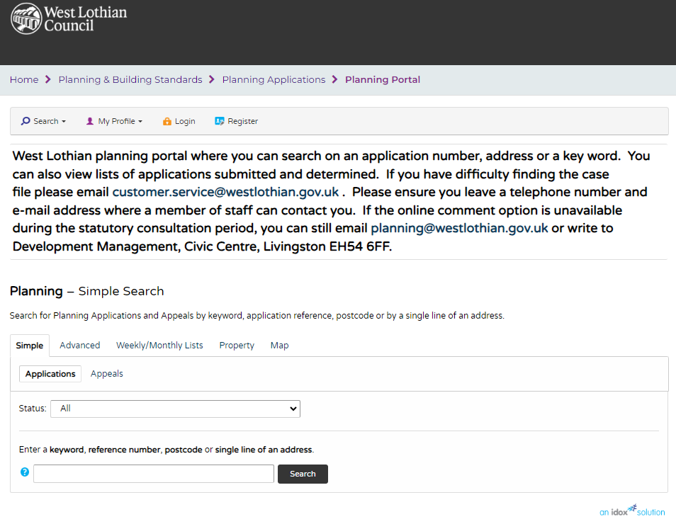
Firstly navigate to the Public Access Search screen of the authority that you are interested in.
https://planning.westlothian.gov.uk/publicaccess/
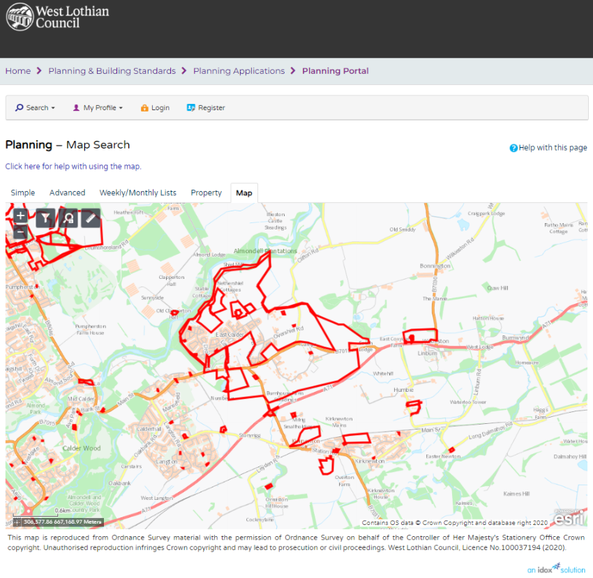
You should be presented with the following screen.
Two thirds of the way down on the right is a tab marked – Map – click this.
You should see something similar :-
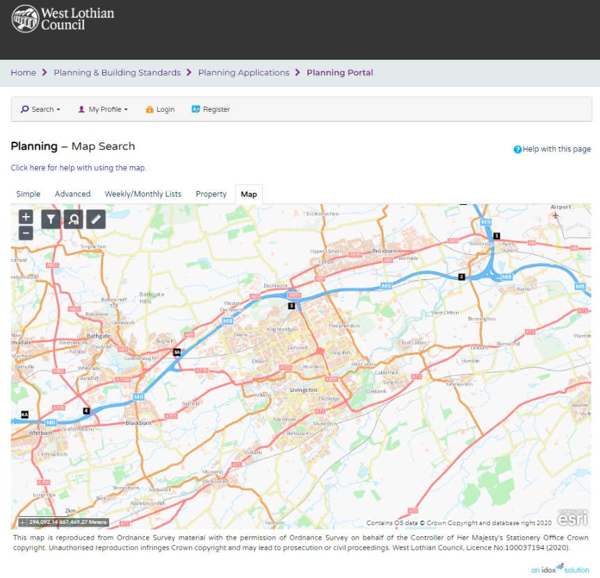
Using your mouse navigate to the land parcel you are interested in determining the planning application history for.
Next hit the filter ICON
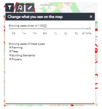
Note on some authority sites this has been replaced by a drop down combination on the right.
Hitting this icon on West Lothian site reveals a slider – initially it is set to 6 months for West Lothian
Chances are you will want to know all of the planning application history so move that slider all the way across to all time.
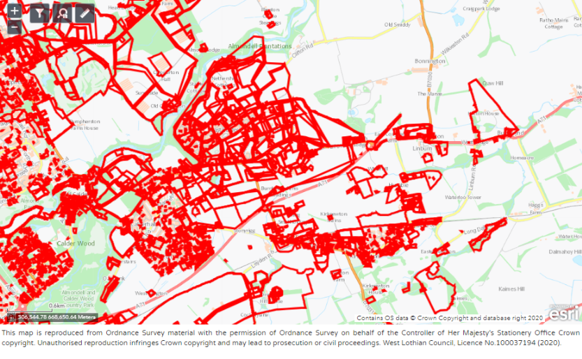
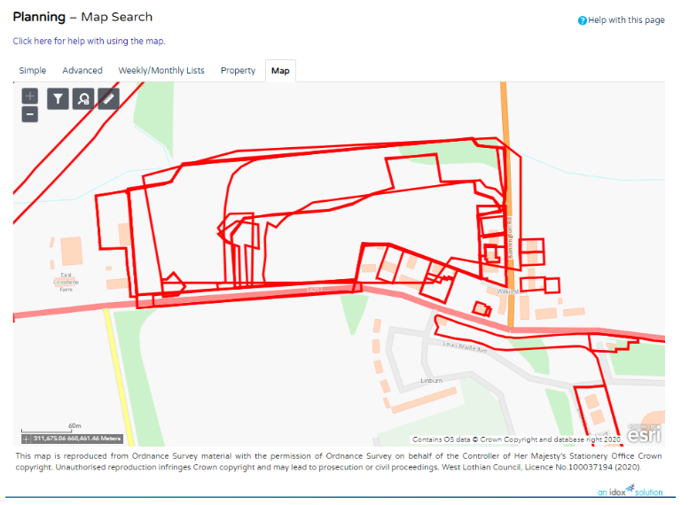
Now back on the map you should see many more boundaries representing many more planning applications.
Users can now zoom in on the particular site they are interested in e.g. Wilkieston below
Now using the mouse you can click at the position you are interested in and the attributes of the planning application at the location you click will be revealed in a further dialog.
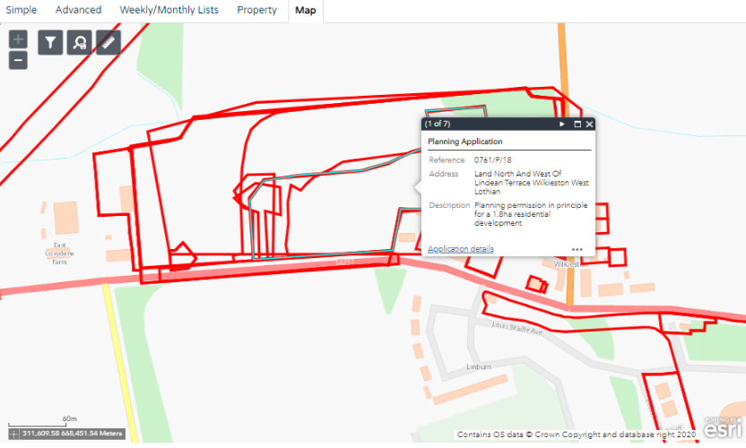
At this point you can note down the planning application references for further research or you can hit the link marked Application Details – here I click on the link related to 0761/P/18
Which takes you to the Planning Application details page.
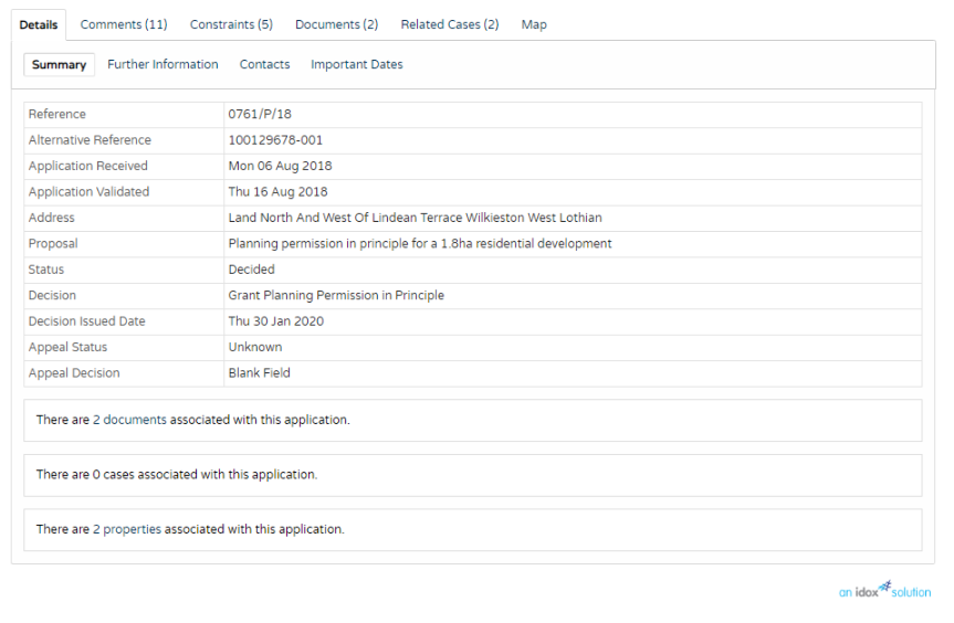
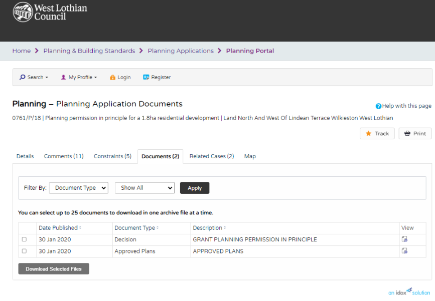
Want to see any available associated documents linked to the application.
Look to the text line beneath the table of attributes. The 2 documents is a link that takes you to available docs linked to the application. The number will be different according to the planning application.

Clicking on it brings up the Planning Application Documents screen where you should be able to download or view the documents.