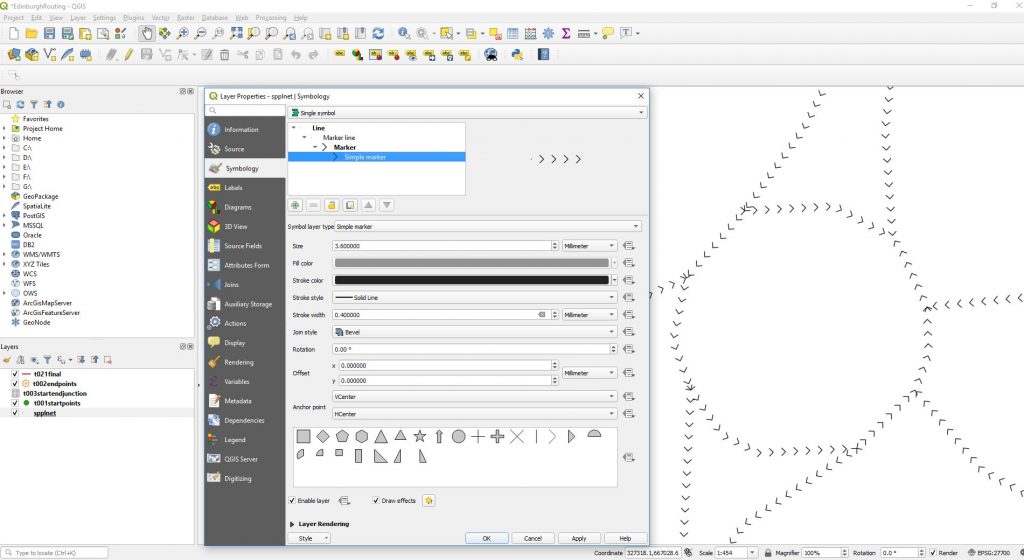
If using the dijkstra function with direction turned on it is important to identify the order in which the nodes of a vector line have been digitised. This is called the direction, dijkstra can use this with a reverse_cost attribute to handicap wrong movement along lines to such an extent that the correct path can be calculated around things like roundabouts.
Here is an example of the roundabout in Straiton in Edinburgh just North of the A720 bypass. While some of the lines have a correct anti clockwise orienation clearly some have been incorrectly digitised.
First we can see this by displaying the network in QGIS but using the styling to arrow the direction.
The function that can be used to reverse such inaccuracies if you can’t resort to buying a correct dataset try ST_REVERSE

